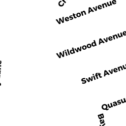
14 SWIFT AVE
Owner Information
WARREN THOMAS
14 SWIFT AVE
WAREHAM, MA 02571


Property Details
14 SWIFT AVE is classified as a Single Family Residential (Bungalow).
The primary structure on this property was built in 1938. There are 1,712ft2 of built area within this property. There is 628ft2 of residential/living space within this property. This property is listed as having 4 rooms.
14 SWIFT AVE is valued at $194,200. The land is valued at $71,300 and the structures are valued at $121,900. There is an additional valuation of $1,000 on this property.
This property is in Zone R30. Confirm with local Zoning Board authorities to ensure there are no overlays or other easements on this property.
The most recent deed for 14 SWIFT AVE is recorded at the local registrar in Book 51130, Page 0168. 14 SWIFT AVE was last sold on Tuesday, May 21, 2019 for $221,700.
Assessment data from fiscal year 2022.
Flood Data
This property is completely within the AE Zone (within floodplain).
The base flood elevation for this flood zone is 15 feet.
This information is sourced from the FEMA National Flood Hazard Layer. See our full disclamer.
Broadband Internet Providers
| Provider | Type | Bandwidth (mbps) | |
|---|---|---|---|
| VSAT Systems, LLC. | Satellite | 2 | 1 |
| Verizon New England Inc. | Fiber | 940 | 880 |
| Verizon New England Inc. | DSL | 5 | 0 |
| Viasat Inc | Satellite | 35 | 3 |
| Comcast | Cable | 1000 | 35 |
| GCI Communication Corp. | Satellite | 0 | 0 |
| HughesNet | Satellite | 25 | 3 |
Broadband service provider data from December 2020.
Adjacent Properties
- 0 TERRY LN
Improved, Selectmen or City Council (Municipal) owned by TOWN OF WAREHAM - 0 FONSECA WY
Undevelopable Residential Land owned by CORNERSTONE ESTATES 2 - 16 SWIFT AVE
Single Family Residential owned by MURPHY PATRICK M - 13 QUASUET AVE
Single Family Residential owned by CARNEY BARBARA A TRUSTEE - 15 QUASUET AVE
Single Family Residential owned by GRIFFIN DIANE, BRUTTI RICHARD A - 11 QUASUET AVE
Single Family Residential owned by GILLIS RICHARD J - 12 SWIFT AVE
Single Family Residential owned by MERCURIO GREGORY